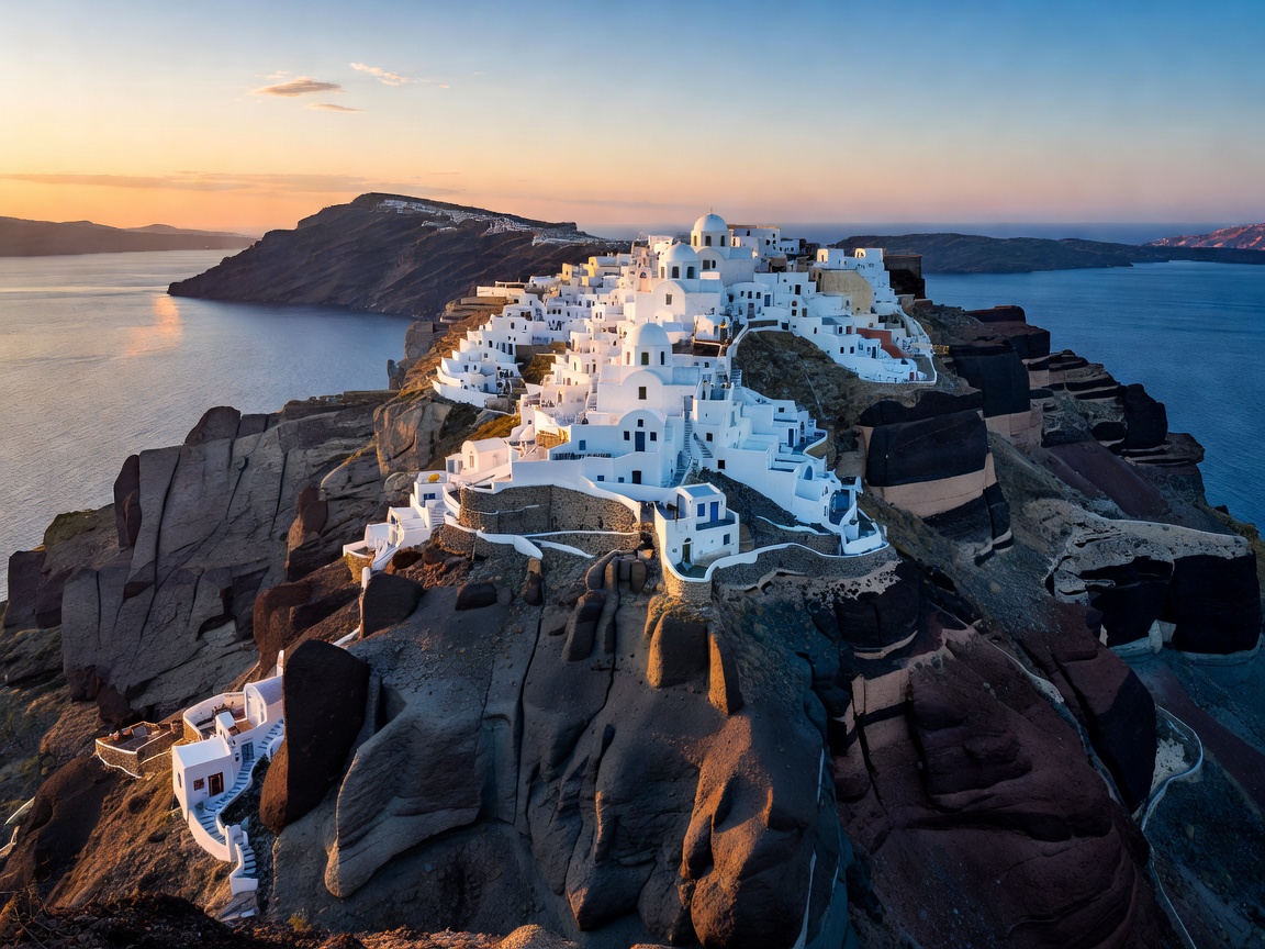
The Volcanic Setting and Cycladic Vaulting
Santorini (historically Thera) owes its dramatic crescent silhouette to the catastrophic Late Bronze Age eruption occurring roughly 3,600 years ago. The central core of the ancient volcanic shield collapsed into the sea, leaving behind a 400-meter-deep flooded caldera bordered by near-vertical cliffs rising 300 meters above sea level. This unique geomorphology dictated an entirely vernacular architectural approach known as yposkafa—vaulted, cave-like structures excavated directly into the soft volcanic pumice matrix.
These troglodytic dwellings were initially created out of functional necessity: volcanic stone offered exceptional thermal insulation against ferocious winter winds and scorching summer heat, while subterranean living protected islanders from pirate raids across the Aegean. In Oia and Imerovigli, barrel-vaulted ceilings with thick lime-washed plaster walls were engineered without timber beams, which were virtually nonexistent on the arid, wind-blasted island.
The Fira to Oia Footpath: Spatial Analysis
The definitive spatial experience of the caldera is the 10-kilometer rim trail linking Fira, Firostefani, Imerovigli, and Oia. Beginning in Fira, the trail ascends past the towering headland of Skaros Rock—a ruined medieval fortress that served as the island’s primary administrative stronghold during Venetian rule. As one proceeds northward toward Imerovigli, the commercial density recedes, opening onto barren volcanic ridges where red and black basalt fragments crunch underfoot.
The trail highlights the stark duality of the island: to the west, an abyss of turquoise water encircling the active volcanic islets of Nea Kameni and Palea Kameni; to the east, gentle agricultural slopes terraced with low, basket-pruned Assyrtiko grapevines (the kouloura method, engineered to shield grapes from harsh Aegean gale-force winds and trap sea mist).
Bronze Age Preservation: The Akrotiri Excavation
On the southwestern tip of the island stands Akrotiri, one of the most significant archaeological sites in the ancient world. Often compared to Pompeii, this prehistoric Minoan-influenced settlement was buried under meters of volcanic ash around 1627 BCE, preserving multi-story stone residences, sophisticated drainage systems, and magnificent wall frescoes depicting maritime fleets, saffron gatherers, and boxing youths.
Unlike Pompeii, no unburied human remains have been discovered at Akrotiri, demonstrating that seismic foreshocks gave the inhabitants sufficient advance warning to evacuate with portable valuables. The modern bio-climatic canopy covering the site allows researchers and visitors to observe ancient paved avenues, clay storage vessels (pithoi), and timber structural reinforcements designed to survive earthquakes.
Comparative Analysis: Caldera Rim vs. Inland Settlements
Caldera Settlements (Fira, Oia, Imerovigli)
- Direct, unobstructed views over the submerged volcanic crater basin.
- Exceptional concentrations of high-end boutique hospitality and dining.
- Intense pedestrian congestion during peak cruise-ship disembarkation windows.
- Elevated room tariffs and steep staircases ill-suited for heavy rolling luggage.
Inland & Coastal Plain (Pyrgos, Megalochori, Emporio)
- Intact medieval fortified layouts (kasteli) with authentic community life.
- Substantially quieter pedestrian environment with minimal daytime crowds.
- Accessible vehicle parking and level walking surfaces.
- Requires rented transport or regional bus transfers to reach caldera vistas.
Practical Navigation and Transit Strategy
To experience Oia’s architectural beauty without crushing crowds, explore its marble-paved alleys between 06:30 and 09:00 before shuttle tour buses arrive from port terminals. Afternoon sunset vantage points near the Venetian castle ruin in Oia attract thousands of spectators; an equally compelling sunset view can be enjoyed with complete solitude from the lighthouse at Akrotiri (Faros) or the heights of Profitis Ilias monastery.
The ferry port of Athinios requires navigation down steep switchback cliff roads. Avoid taking heavy luggage on public buses during peak departure hours; pre-booked private transfers or departing via Santorini Airport (JTR) offer more predictable timing.